

Well, it only took until October 6th (well past the peak of the season on September 10th), but it looks like we’ll get out first hurricane of the year, and it’ll be a direct hit on the gulf coast. Highest chances for landfall look like the far western tip of Florida where it meets Alabama and Mississipi. All subject to change within the cone of uncertainty (image below). Here is the rough timeline of events.
Tuesday- Named tropical depression #1.
Wednesday - Tropical storm Arthur rapidly intensifying - 45 mph @ 5AM.
Thursday - Likely Hurricane Arthur
Friday AM - Arthur will probably peak in strength, current models estimate around 115 mph, but strength is the hardest part of hurricane forecasting.
Friday PM - Arthur should weaken a little due to the vertical shear and rapid increase in forward speed. Should be a Cat 3 at least (115 mph+), maybe higher, before weakening just before landfall.
Saturday - Arthur will hit around that little area where Mississippi meets Florida and Alabama, on Saturday morning. By end of day, it will get downgraded to a tropical storm while it rides up west of the Appalachians. It will be moving quickly around 20-25 mph to the northeast. Columbus Day Tournament in Virginia Beach will be a go for Saturday, no real weather.
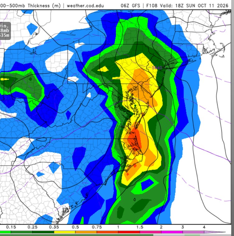
Sunday - Expect to get hit hard ALL DAY LONG. 1-3 inches expected along with 25-30 mph winds. Please pay attention to this site for Sunday’s weather because it will make for a miserable Columbus Day soccer tournament, as of today’s model runs. Arthur will be a tropical depression but don’t let that fool you. It’s like squeezing out a sponge, over top of us all day long. Lightning — probably not — just huge tropical raindrops and winds all day. Come prepared.
Monday - Cleanup, sunshine returns, Virginia Beach starts drying out.
2 inches projected for Virginia Beach from Arthur
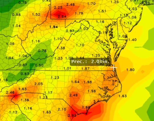
1.5 inches in just 3 hours around Noon Sunday - expect 2-3 inches total.
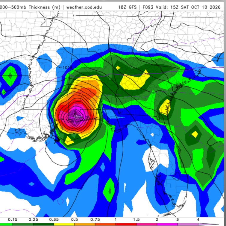
Landfall: Saturday morning, Definitely looks strong, well formed eye, lots of weather to the East of the storm.
Current NHC Track: Note — all the weather will be to the East … in VB!
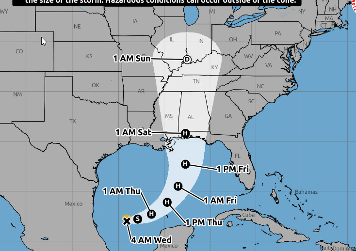
Arthur’s Track: well West of here but the impacts will be well East of this track. We will get side-swiped.
Best Arthur Satellites Loops:
Best Overall Loop
Best Visible Loop
Forecasted Track
Wind Forecast
Rain Forecast
Technical “Discussion” from the National Hurricane Center about Arthur

Shout out to my wife Jenny and her Broad Bay Country Club Tennis Team who was supposed to compete in the USTA National Tennis Tournament in Georgia this weekend in singles and doubles. Months of training put “on hold” as the Tournament just got postponed. Will root her on wherever and whenever they reschedule it!