Winter's Last Gasp: Might it really happen!?!?
Snowfall chances increase for Monday 2/23. More models in agreement!

Chance of Snow: 65%…up from 40%. no longer having to hedge…more and more models coming into agreement of a major snowfall events… just matter of who gets it
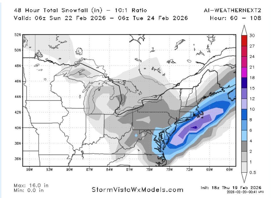
Snowfall prediction as of now: 6 inches — same from yesterday. based upon today’s models. Roads are warm, will take a while to stick — it’s all about where the LOW is positioned and we are 120 hours away. The low has to be within a 20 mile zone for this to occur.
Chance of school getting cancelled: 100% if this verifies, and probably for 2-3 days — temps are going to warm up next week to the 40’s and higher so melting will occur, and I think Friday will be a normal, school day.
When? starting early Monday AM (like 1 AM), ending Monday evening
More of the models are coming around. I have posted a few below. While the overall crazy high totals have come down, what’s more interesting is that more are confirming that a significant snowfall event will occur. We are still 4 days out. There was a major change toward the snowfall event today. What will the next few days bring? Stay tuned. For now here are the latest pics.
Please Lucy: don’t move that football! This has happened all year to us.

5.4 inches with the ECWMF: The European model.
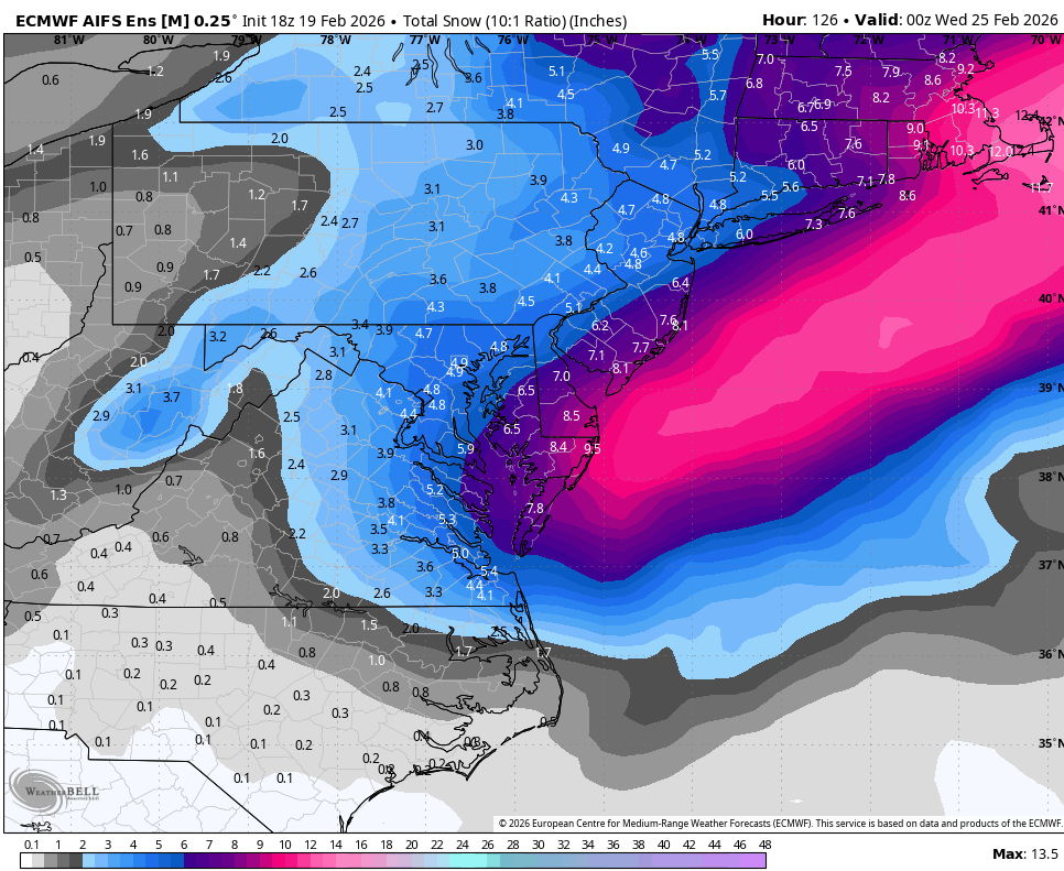
An average of models says to expect 6-8 inches.
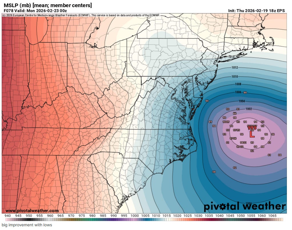
Check out the low wrapping up nicely, right on the eastern shore, dragging down the cold air (counterclockwise flow).
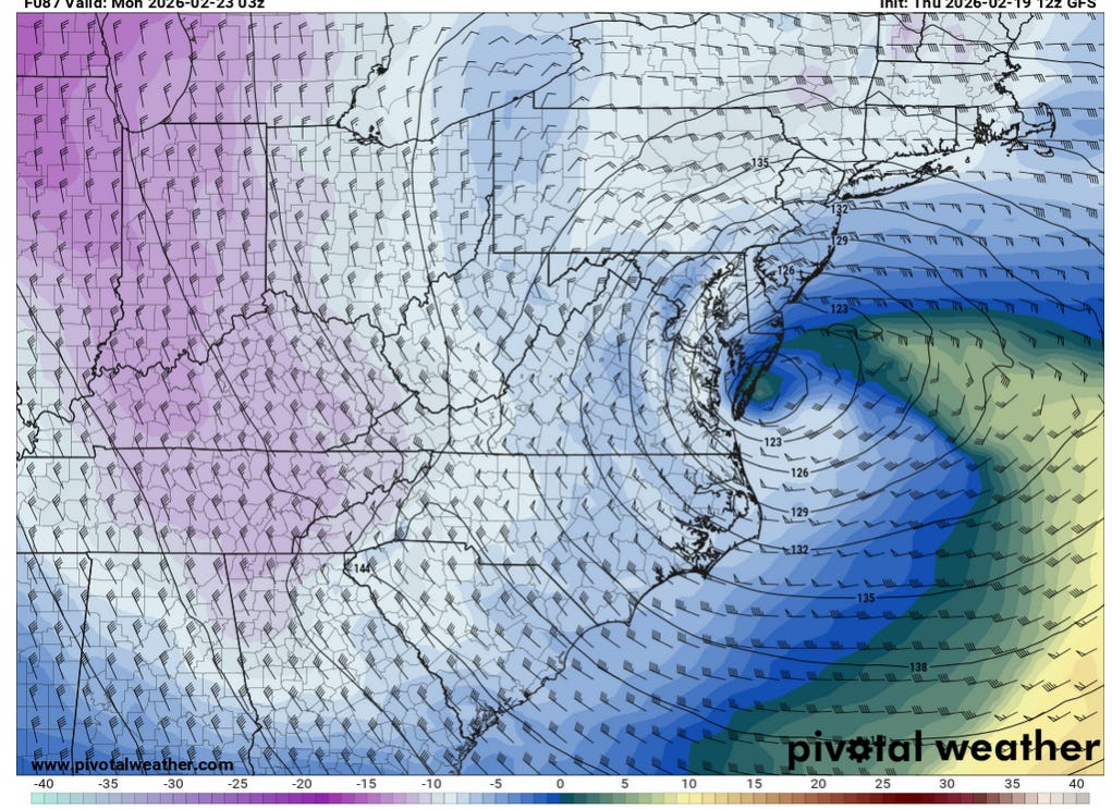
Perfect position for a classic northeaster here.